The best cava routes in the Penedès and Alella
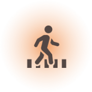
Excursions and wine tourism hiking that can be covered comfortably on foot or by bike.
These trails can be covered comfortably on foot, and most of them also by bicycle. It’s very easy: enter the interactive website, select the trails you want to travel, activate geolocation and visit whichever wineries you like.

Routes through the vineyards
Cava Ways is a wine tourism initiative that offers visitors a network of trails through an interactive website.
Visitors are free to choose their own itinerary, making it as easy as possible to get from one winery to the next.
There are three zones on the map: Sant Sadurní d’Anoia, Vilafranca del Penedès and Alella.
This proposal combines walks or bike rides through vineyards with visits to wineries and fine dining at local restaurants in the area.
The interactive website features over thirty participating wineries, as well as restaurants, accommodation options, and other points of interest such as shops, bike rental companies, parking lots, and museums.
Customized hiking routes
Mark the sections you want to cover, customizing the route, and the web app will indicate the difficulty level of each section, as well as the estimated time to complete it.
Here is a step-by-step guide:

1
Touch the points on the map to view detailed information.

2
Mark as favourites the points you want to visit. Displays only the points marked with the favourites icon on the map.

3
Show and hide other categories of services on the map

4
Touch the paths to view detailed information and mark them to add them to your route
5
The paths with dotted lines can only be travelled on foot. The paths with solid lines can be travelled on foot or by bike.

6
Activate your location and use your geolocation and compass to find your way.
1
Touch the points on the map to view detailed information.
2
Mark as favourites the points you want to visit. Displays only the points marked with the favourites icon on the map.
3
Touch the points on the map to view detailed information.
4
Touch the paths to view detailed information and mark them to add them to your route
5
The paths with dotted lines can only be travelled on foot. The paths with solid lines can be travelled on foot or by bike.
6
Activate your location and use your geolocation and compass to find your way.
What you will find on the Cava Ways interactive map
Wineries
34 cava producers waiting for you to visit them.
Restaurants
Dining options, some within wineries
Accommodation
Stay overnight and enjoy the routes
Information point
Plan your custom getaway
Bike rental
A practical service for you to enjoy the route
Shops
Specialized shops so you can enjoy cava even more
Places of interest
The most beautiful spots for taking photos
Activities
Enjoy cultural activities in the area
Car parks
Park up comfortably and get around on foot or by bike
Transport
Get there by car, train, coach or public transport
Discover the wineries
The heart of the wine tourism activities are the wineries.
Check the information before visiting them: opening hours, services, if prior booking is required, prices, types of tours, and an interesting review of what they are like and why you should visit them.
Plan your route to combine one or more wineries that are close to each other.

Start your cava route with the interactive map
It’s very easy. All you need is a mobile phone and the desire to have a great time. Mark the paths that lead you to your destination and let the app guide you.